Portfolio
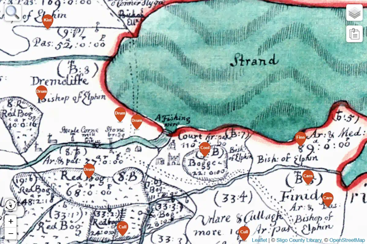
Geo Nua Map Systems
We create layered systems that combine historical maps with contemporary data, allowing even maps from the 1600s to be explored as effortlessly as those of today.
Learn more on our map systems page, or go to Sligo County Library's website and explore the shown map view live.
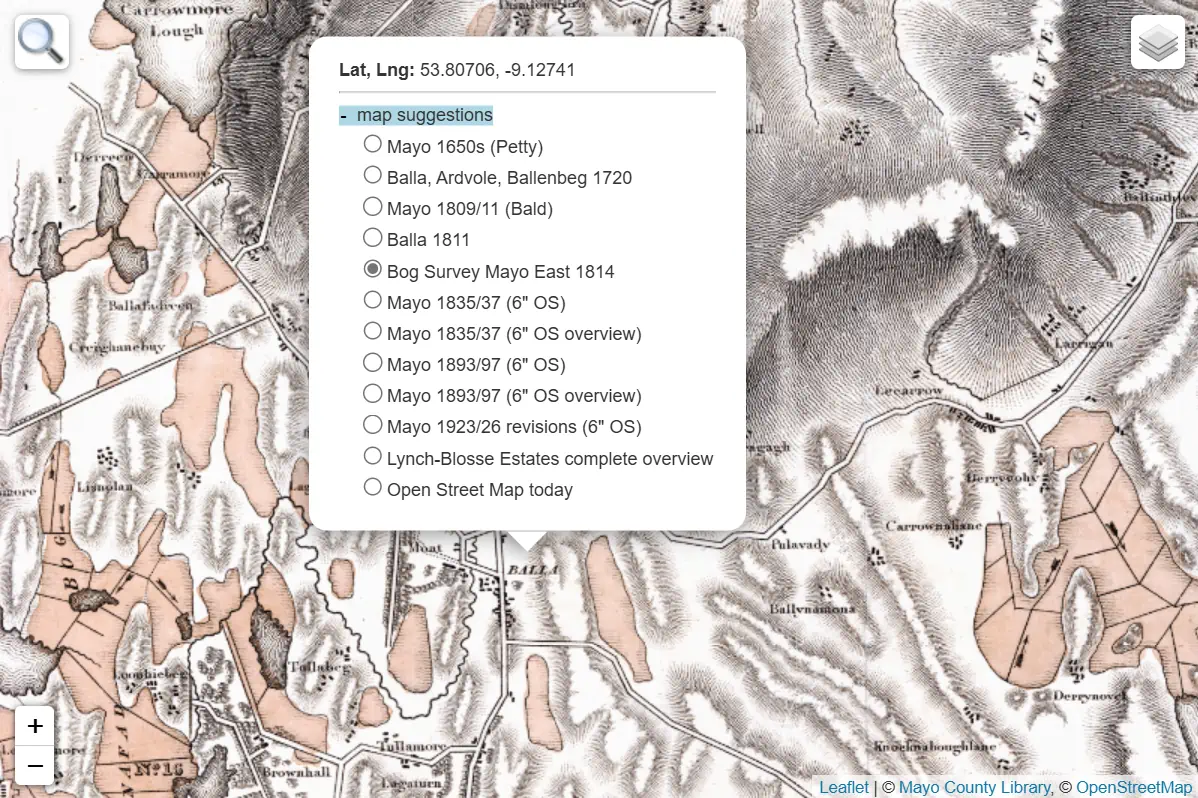
Map Searches in our map systems
Find historical maps by simply right-clicking or long-tapping any location. Results appear in chronological order, allowing a seamless journey through time.
Learn more on our map systems page, or go to Mayo County Library's website and explore the shown map view live.
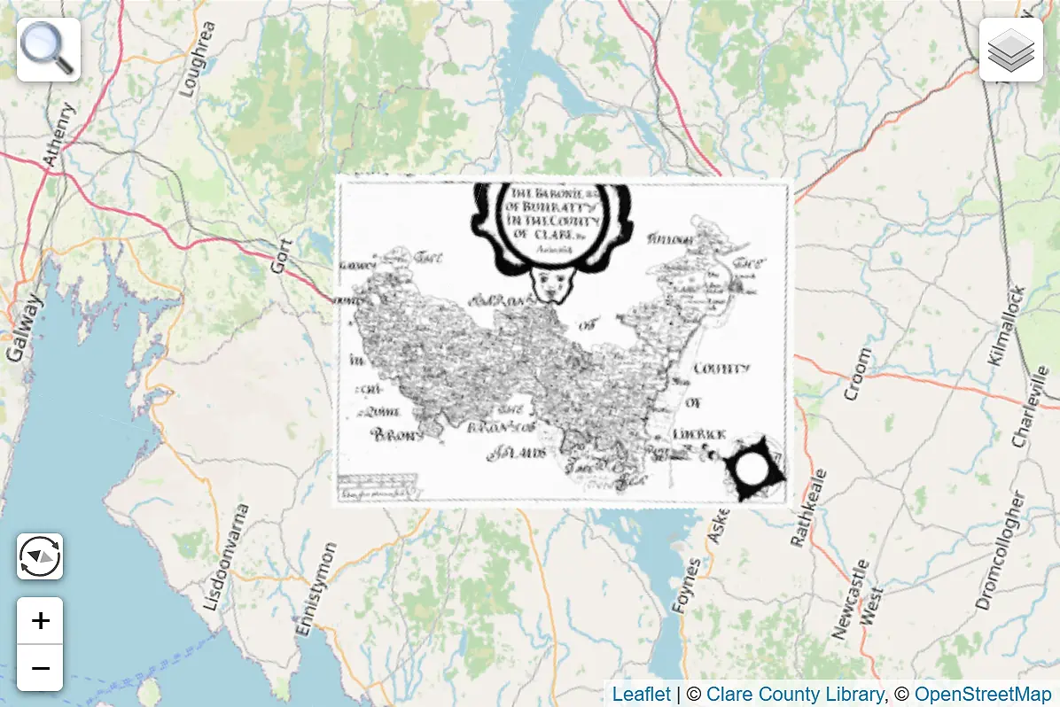
Map Rotation in our map systems
Rotate historical maps freely.
Use the
 compass button to toggle between North-up and the map’s original orientation.
Learn more on our map systems page, or go to Clare Libraries' website and explore the shown map view live.
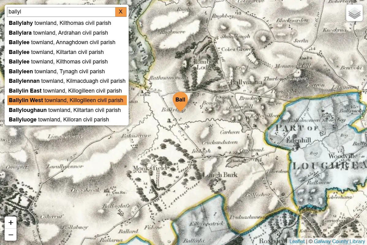
Location Search in our map systems
Find places by name using the
 search button
and see related historical maps or data. Each result adds an orange marker — bookmarkable, shareable, and ready to explore.
search button
and see related historical maps or data. Each result adds an orange marker — bookmarkable, shareable, and ready to explore.
Learn more on our map systems page, or go to Galway County Library's website and explore the shown map view live.
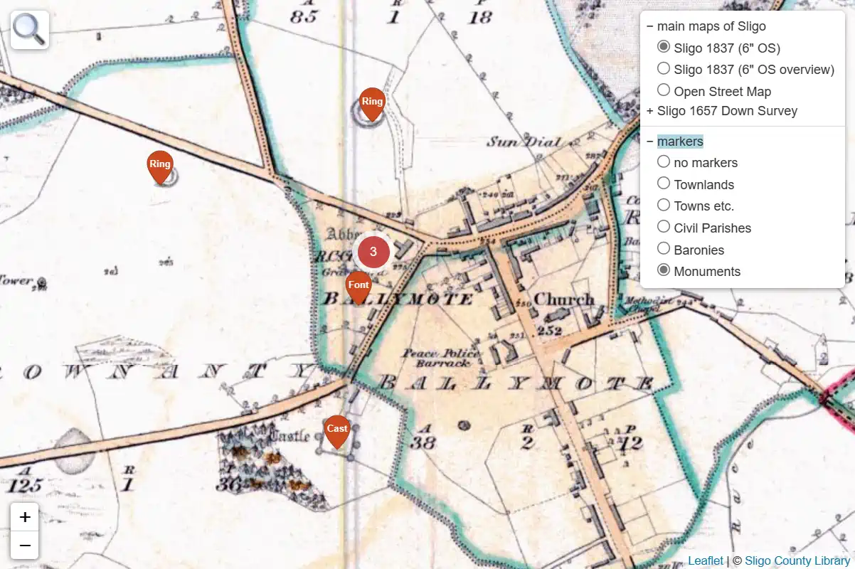
Location Markers in our map systems
Add curated points of interest to the map using the
 layers button.
Click or tap a marker to reveal location-based map suggestions and data links.
layers button.
Click or tap a marker to reveal location-based map suggestions and data links.
Learn more on our map systems page, or go to Sligo County Library's website and explore the shown map view live.
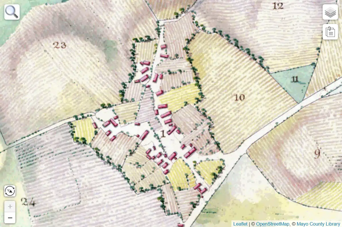
Map Attachments in our map systems
Attachments can offer essential context through reference sheets and full scans, sometimes revealing that a map is a later copy.
Use the  attachment button,
and then zoom and pan an attachment like a map.
attachment button,
and then zoom and pan an attachment like a map.
Learn more on our map systems page, or go to Mayo County Library's website and explore the shown map view live.
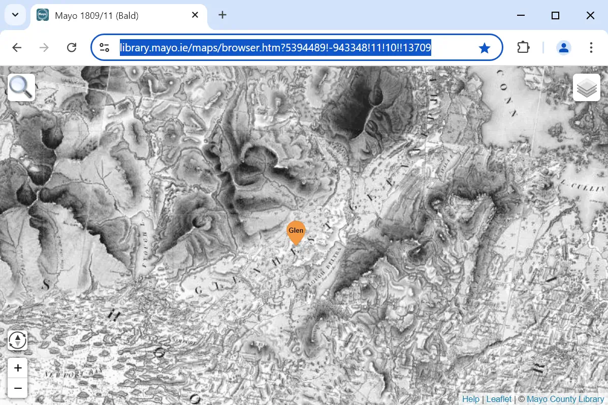
Bookmarking and Sharing in our map systems
Bookmark or share map views and searches. The address bar keeps track of map layer, zoom, and location, making it easy to return or collaborate.
Learn more on our map systems page, or go to Mayo County Library's website and explore the shown map view live.
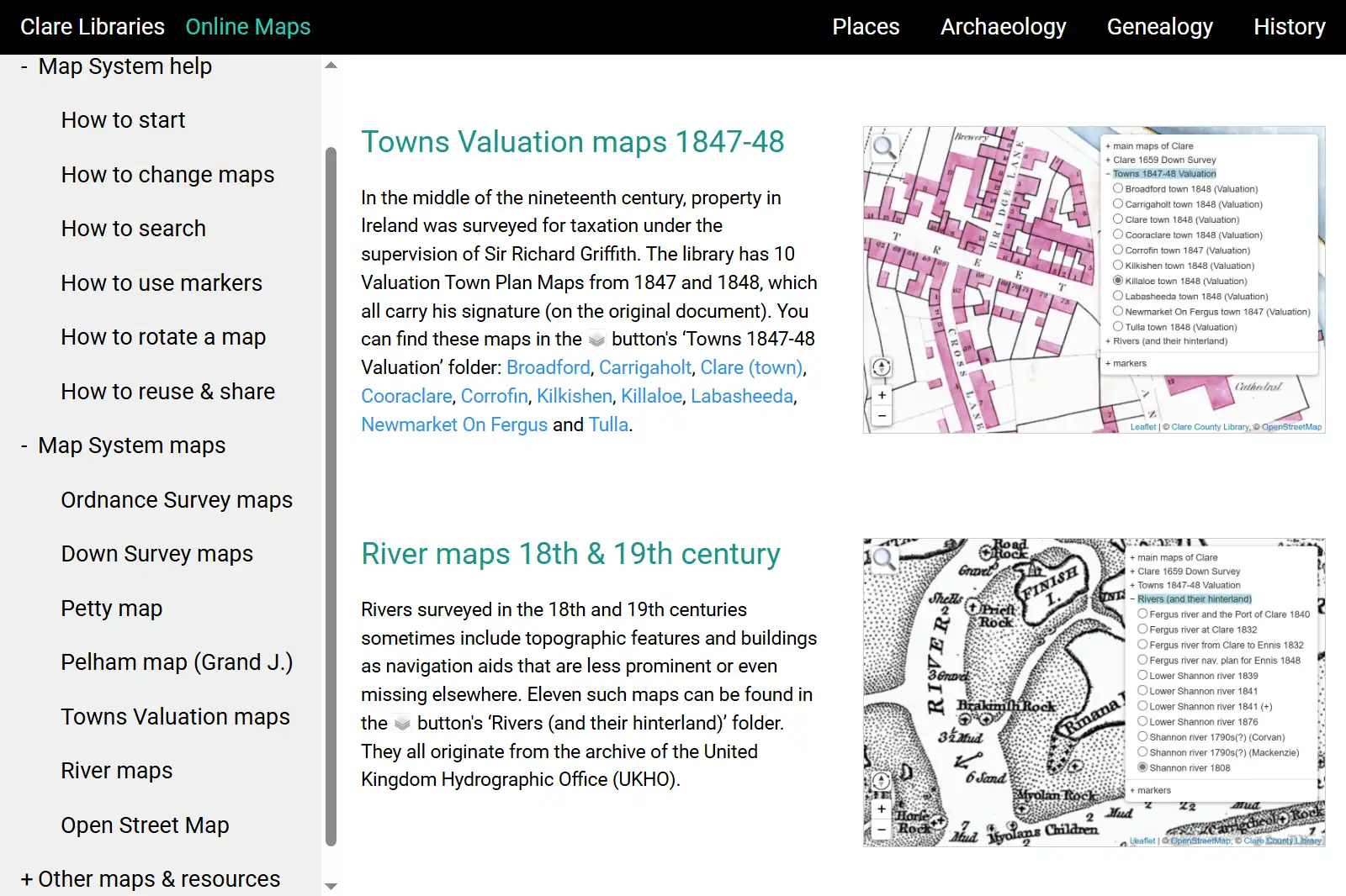
Help Pages for our map system
Get professional start and help pages for your map system. Interactive screenshots make exploring and understanding the maps intuitive and quick.
Learn more on our map systems page, or go to the websites and help pages of these libraries: Clare Libraries, Galway County Library or Sligo County Library.
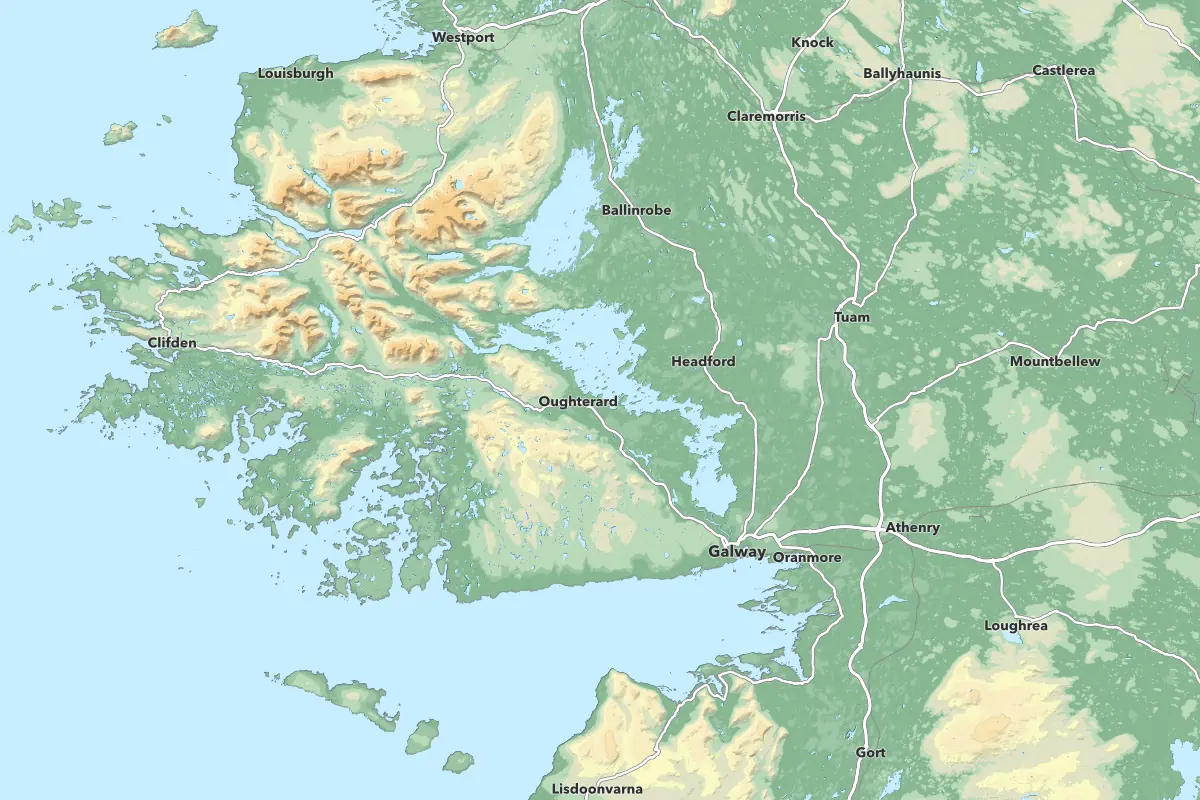
Our topographic map at county/province scale
Perfect for showing the wider physical context of any project area, infrastructure, or service network.
Learn more on our mapmaking page.
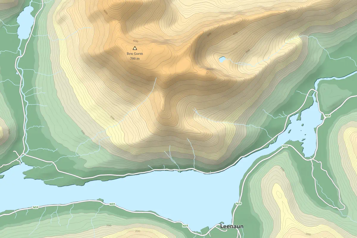
Our topographic map at mountain range scale
Ideal for illustrating trail systems, protected areas, or landscape studies.
Learn more on our mapmaking page.
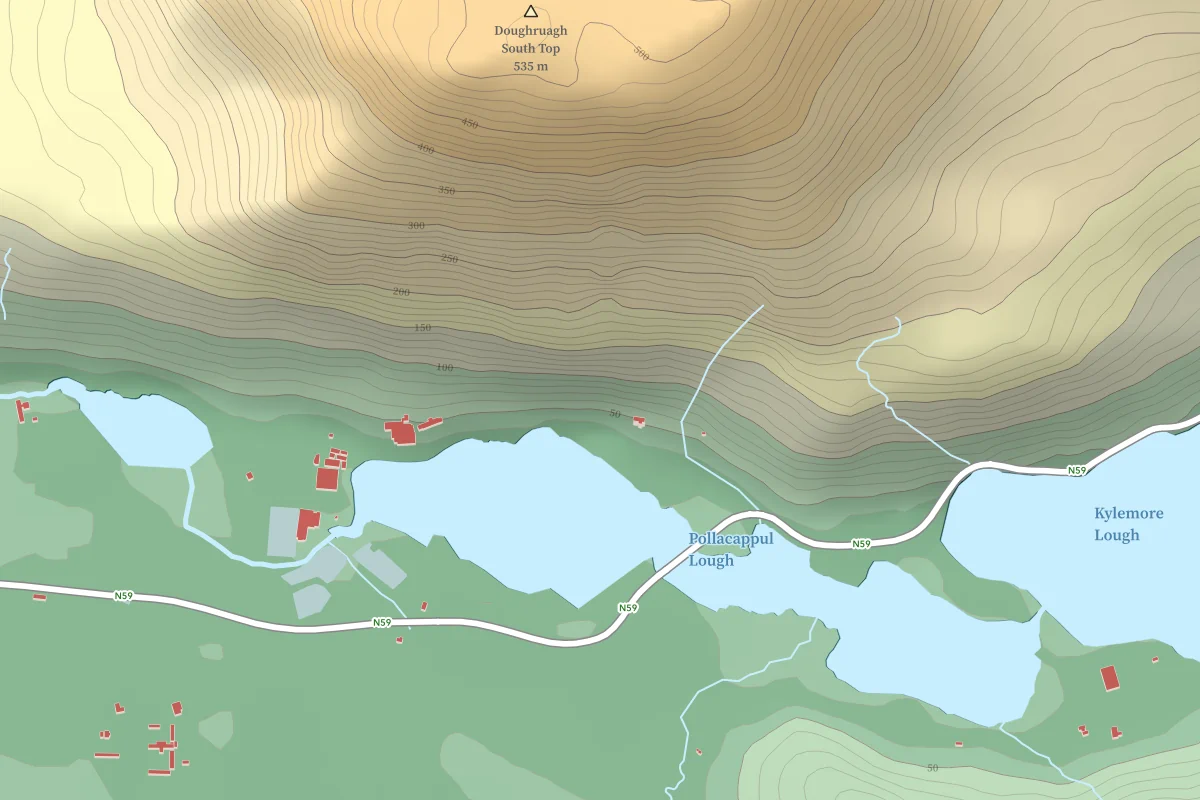
Our topographic map at townland scale
A practical scale for local planning, heritage projects, or community mapping.
Learn more on our mapmaking page.
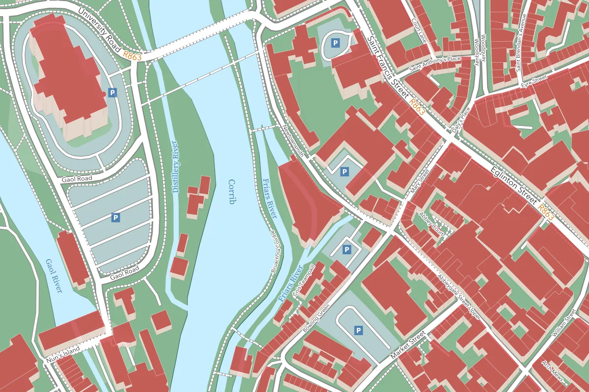
Our topographic map at city centre scale
Well suited for urban mapping, accessibility studies, or local business overviews.
Learn more on our mapmaking page.
About Geo Nua
I’m a software developer and historian living by Ireland’s Clew Bay, drawn to maps as gateways to forgotten sites, untold stories, and lost communities. What began as a personal fascination grew into Geo Nua — where we turn spatial data into maps, dashboards, and online systems.
Contact
We’d love to hear from you — whether it’s a map idea, a collaboration, or just a question about our work. You can reach us at geonua.info@gmail.com. We usually respond within 24 hours.